What. Why. How. ❓

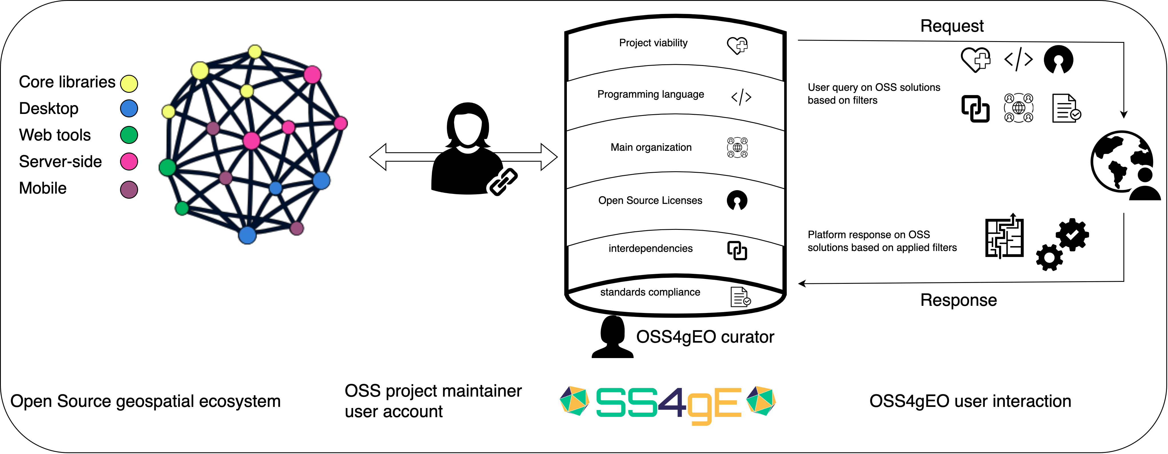
Open Source For Geospatial Software Resources Platform For Geospatial Data Exploitation (FOSS4G Observatory) is an initiative that works to develop an open, interactive, user intuitive platform for a constantly updated, comprehensive and detailed overview of the dynamic environment of the open source digital infrastructure for geospatial data storage, processing and visualisation systems. The initial development of the Open Source for Geospatial Software Resources platform builds on previous extensive work started in 2016 that has materialised into a pioneering overview of open source solutions for geospatial, voluntarily updated by the team. Starting in 2023, FOSS4G Observatory has become a part of a wider ESA EO Open Innovation initiative to actively support and contribute to the EO and geospatial open source community and it is intended as a seed action to better understand, represent and harvest the geospatial open source ecosystem. The FOSS4G Observatory project aims to build and lay the foundations for the community to maintain an open source geospatial software repository that will function as an extended metadata catalogue, curated by the community for the community, and a tool for metrics computation, visualisation, ecosystem statistical analysis and reporting. The main overarching objectives of the FOSS4G Observatory are the following: To offer an informed and as complete as possible overview of the open source for geospatial and EO ecosystem, together with various capabilities of filtering and visualisations, within the platform as well as technical solutions to programmatically access and extract data from the database (APIs) to use in any purpose, including commercial; To provide guidance through the complexity of the geospatial ecosystem so that one can choose the best solutions, while understanding their sustainability, technical and legal interoperability and all the dependencies levels; To serve as a community building, a promoting and maintaining platform for new and innovative open source solutions for EO and geospatial, developed within various projects, research centres, small or large companies, universities or through individual initiatives. The platform will allow specific and standardised contributions from the OS projects developers/coordinators that will be able to edit data using their validated account. The validation will be done by the FOSS4G Observatory curator (that, at this point, will be part of the implementing team). The scope is to collect information regarding governance model, software licences, means of distribution, development sponsorship, documentation, cross-project dependencies, weather it requires “fenced” access to information (eg. AWS requester-pays), sustainability of the project (if the development of the project is based on some funding mechanism), information regarding compliance to various community accepted standards (eg. OGC, ISO, IEEE), parent organisation that provided the initial support or which is driving the current development. Based on the collected data, the platform will allow - through the implemented functionalities - inspection of the various filters, providing a deeper understanding of the inter-connections between them, both technical and also socio-economical.